Author: Charlie Farrugia
Senior Collections Advisor, Public Record Office Victoria
The 13th of December marks 100 years since the opening of Luna Park in St Kilda. In seeking to find records in our collection about this Victorian icon, I also located information about the range of amusements that were on offer well into the 1960s.
I started my search by consulting the detailed survey plans created by the former Melbourne and Metropolitan Board of Works (MMBW) (VPRS 8601). This series of plans, drawn on a scale of 40 feet to one inch, was used by MMBW staff to plot water, sewerage and drainage works. Plan number 1368 covers the area of the present day Luna Park and adjacent triangular area which today is the site of the Palais Theatre and car parks. Streets, allotments, permanent structures and other features are depicted on the map in addition to the works.
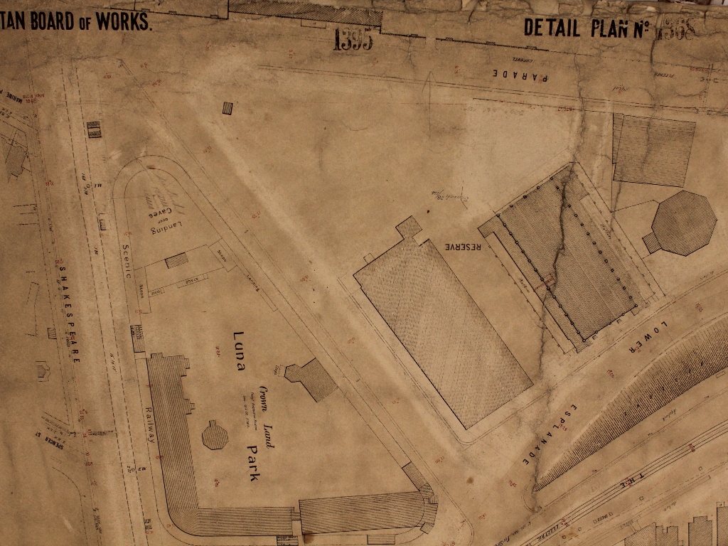
Like all of the original items in this series, plan 1368 was created by the Board in the 1890s. It was subject to constant revision and amendment as a result of the demolition of old or the construction of new structures until circa 1953 when the Board redrew and renumbered all of its plans.
The Board’s draughtsmen drew and amended these plans from a sequence of uniquely numbered surveyor’s field books. (These are in our collection as VPRS 8600.) A table in the top right had corner of the plan identifies the field book[s] from which it was drawn. Annotations underneath this table identify the field books from which any subsequent amendments were made. This field book detail is crucial for anyone wishing to gain knowledge of the build up of a particular site or area. If a building was demolished, evidence of that structure was removed from the plan and the new structure added in its place.
Anyone wanting to find a drawing of the demolished structure would need to consult the field book drawing as this is the sole surviving record. The Board deliberately omitted this field book information from the published lithograph versions of the plans which are today available in other collections in Victoria.
Survey field book number 1033 records the original survey conducted in the early 1890s and shows the Luna Park site as vacant land. The first amendment listed on the map refers to field book number 678. Pages 154 to 160 of this book show a survey conducted during September 1906 indicating the construction of a number of structures, including some which were then incomplete. Specific buildings identified include a weatherboard ticket office, a rotunda, a number of toilets, a large iron circular structure, other buildings and fences. These buildings were the
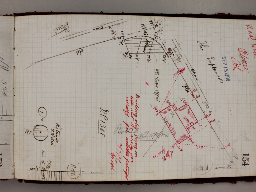
first amusement park to have been constructed on the site. Known as “Dreamland”, it was unsuccessful and closed after a relatively short period. Field book number 1236 (page 145) contains a survey dated 13 January 1910 indicating that all buildings and fences had been removed.
The survey to plot Luna Park was made on 10 October 1912. (Refer to field book number 1689, pages 123 to 126). Whilst all of the permanent structures are included, only two of the Park’s features, the iconic scenic railway and the river caves, are specifically identified. The only other subsequent amendments were made in 1913 with the addition of more toilets and a structure leading from inside the entrance alongside the Esplanade frontage to connect up with other existing buildings (refer to field book number 1742 pages 81-82 and 151).
As the post 1953 plan is yet to be transferred to PROV, I next decided to check the former Health Department’s Public Building File (VPRS 7882) on Luna Park. Unfortunately, the file only starts from 1960, papers created beforehand having gone astray in the period prior to their transfer to archives probably in the period prior to the establishment of the Public Records Act. These files document Health Department efforts to ensure that, as a public building, the Park did not pose a health or safety risk to the public.
One of the earliest documents on file, dated 25 August 1961, identifies all of the features of the Park as it approached its 50th anniversary. How many of these do you remember? The Spinner, The Merry-Go-Round, Have A Whale Of A Time, Ray Guns Building, Dodgem Ride, The Whip, The Giggle Palace, The Rotor, The River Caves, The Scenic Railway and The Big Dipper.
By this stage, the adjoining triangular area had well and truly developed with the construction of the present day Palais Theatre and the now demolished Palais de Danse and other amusement structures. The development of these features can likewise be charted on the MMBW plans and field books as well as in the public building files.
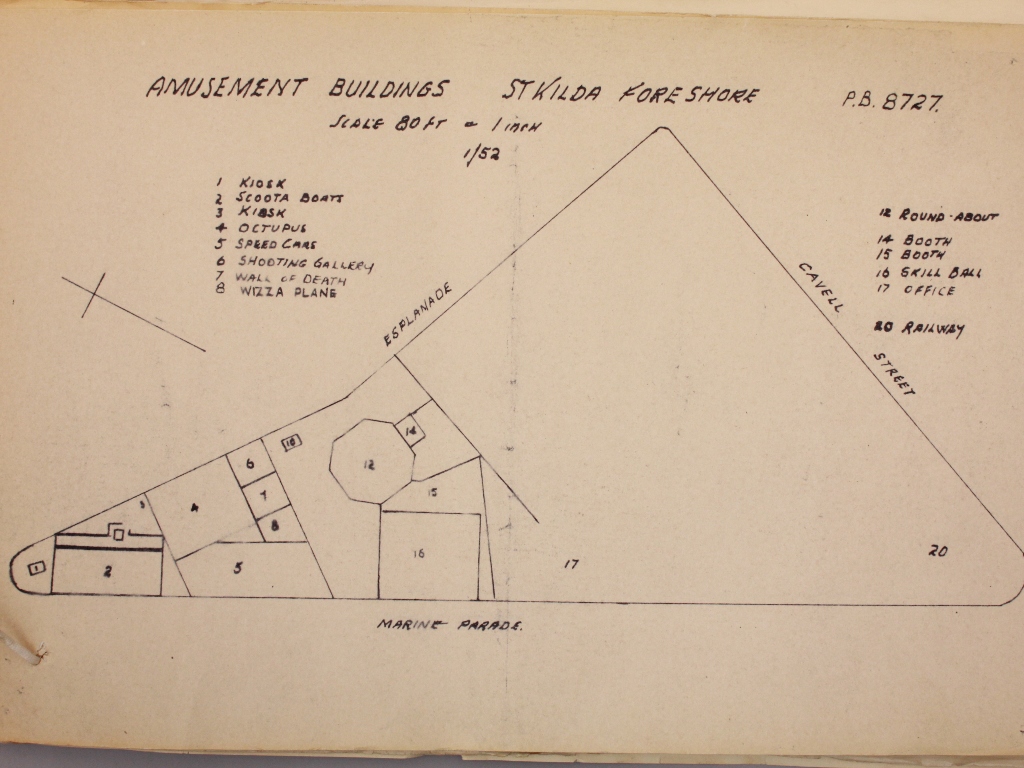
One of the public building files, titled Amusement Buildings – Foreshore – St Kilda (file 8727 in VPRS 7882/P1, unit 1024) contains this plan from 1952 showing the range of delights on offer in a portion of the car park area. Specific attractions mentioned included Scoota Boats, the Octopus (a ride), Speed Cars, the Wall of Death (a motorcycle stunt), the Wizza Plane, a Round About and Railway.
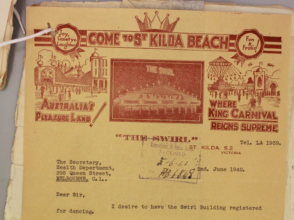
Structure number 16 on this plan was identified as the Skill Ball Parlour. Another public building file (number 6848 in VPRS 7882/P1, unit 808) indicates that this was just one of its many uses over time. Known as “The Swirl Building” the building ran electric “Swirl” cars, then operated as the Fascination Dance Hall, which was a venue for “housey-housey” (a bingo type game) and eventually finished as a dodgem car venue. The Health Department also received applications for the building to be used as a roller skating rink.
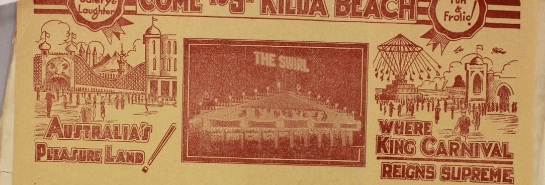
What I particularly liked about this file was The Swirl’s letterhead showing Luna Park and the beach area adjacent to the sea baths containing a flying amusement. Add to this the Palais Theatre, the St. Moritz skating rink and myriad other attractions, it seemed only appropriate that the letterhead read “Come to St Kilda Beach, Australia’s Pleasure Land! Where King Carnival Reigns Supreme.” However that was 50 years ago and it would appear that Australia’s seaside recreation crown now resides with Surfer’s Paradise. But none of this should detract from the major role that Luna Park and St Kilda has played in entertaining the people of Melbourne over the last 100 years.
Material in the Public Record Office Victoria archival collection contains words and descriptions that reflect attitudes and government policies at different times which may be insensitive and upsetting
Aboriginal and Torres Strait Islander Peoples should be aware the collection and website may contain images, voices and names of deceased persons.
PROV provides advice to researchers wishing to access, publish or re-use records about Aboriginal Peoples
